Unbekannt (18. Jahrhundert), Antike Karte, Belgien, Frankreich, Ath, Conde, 1776, Kupferstich
- Technik: Kupferstich auf Büttenpapier
- Datierung: 1776
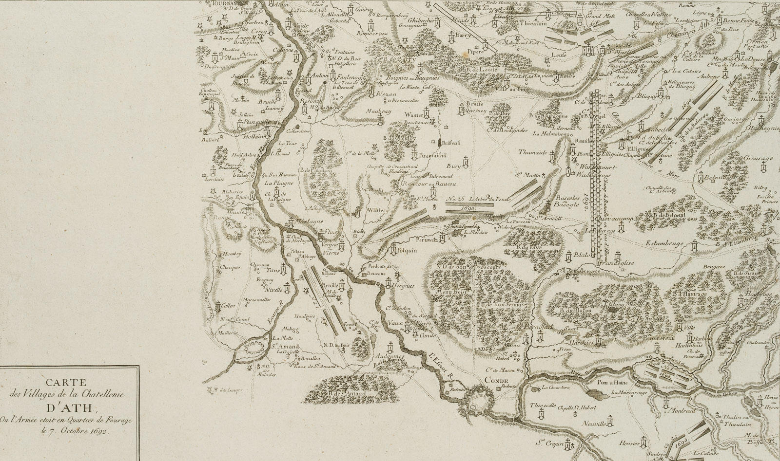
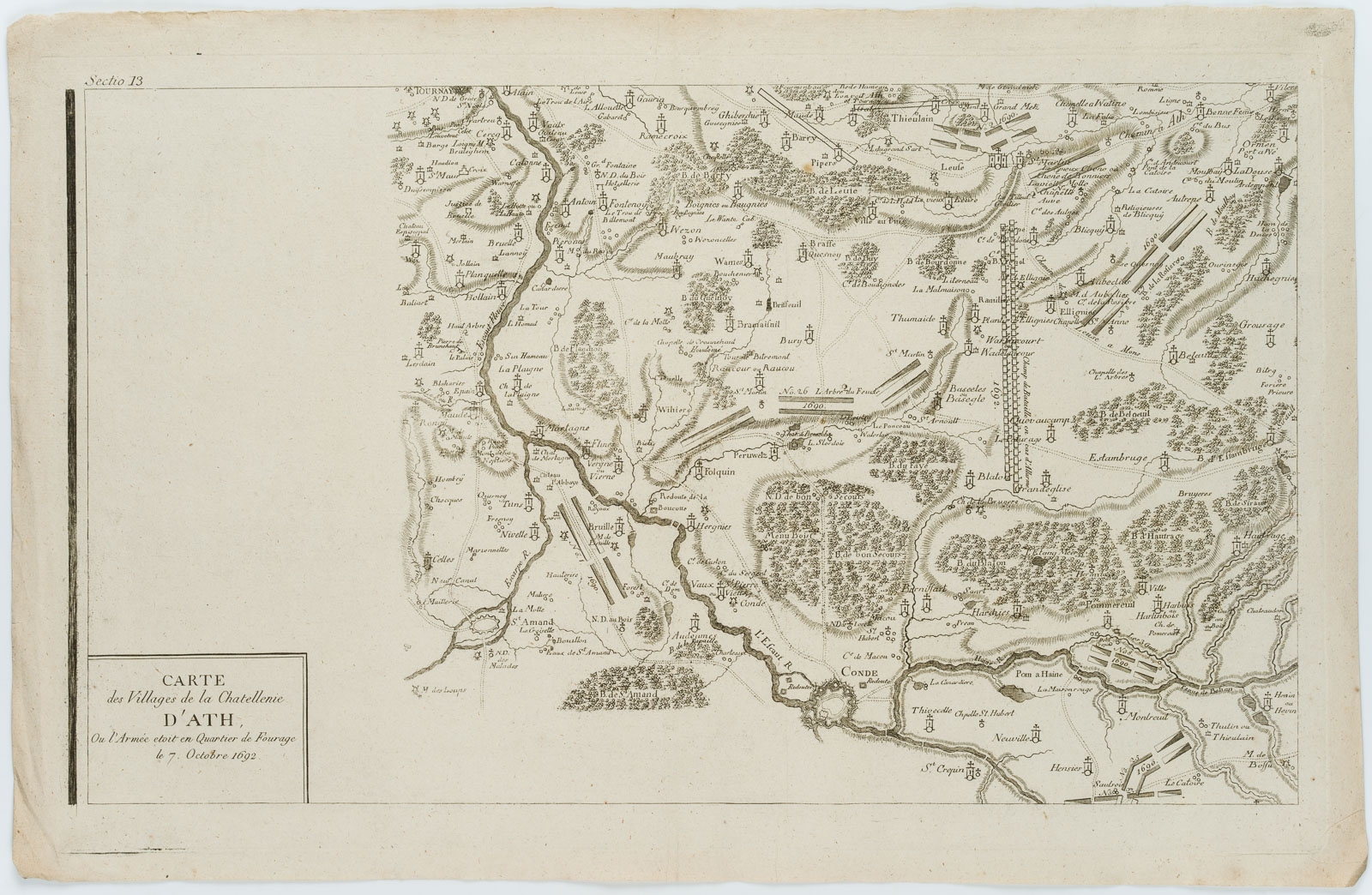
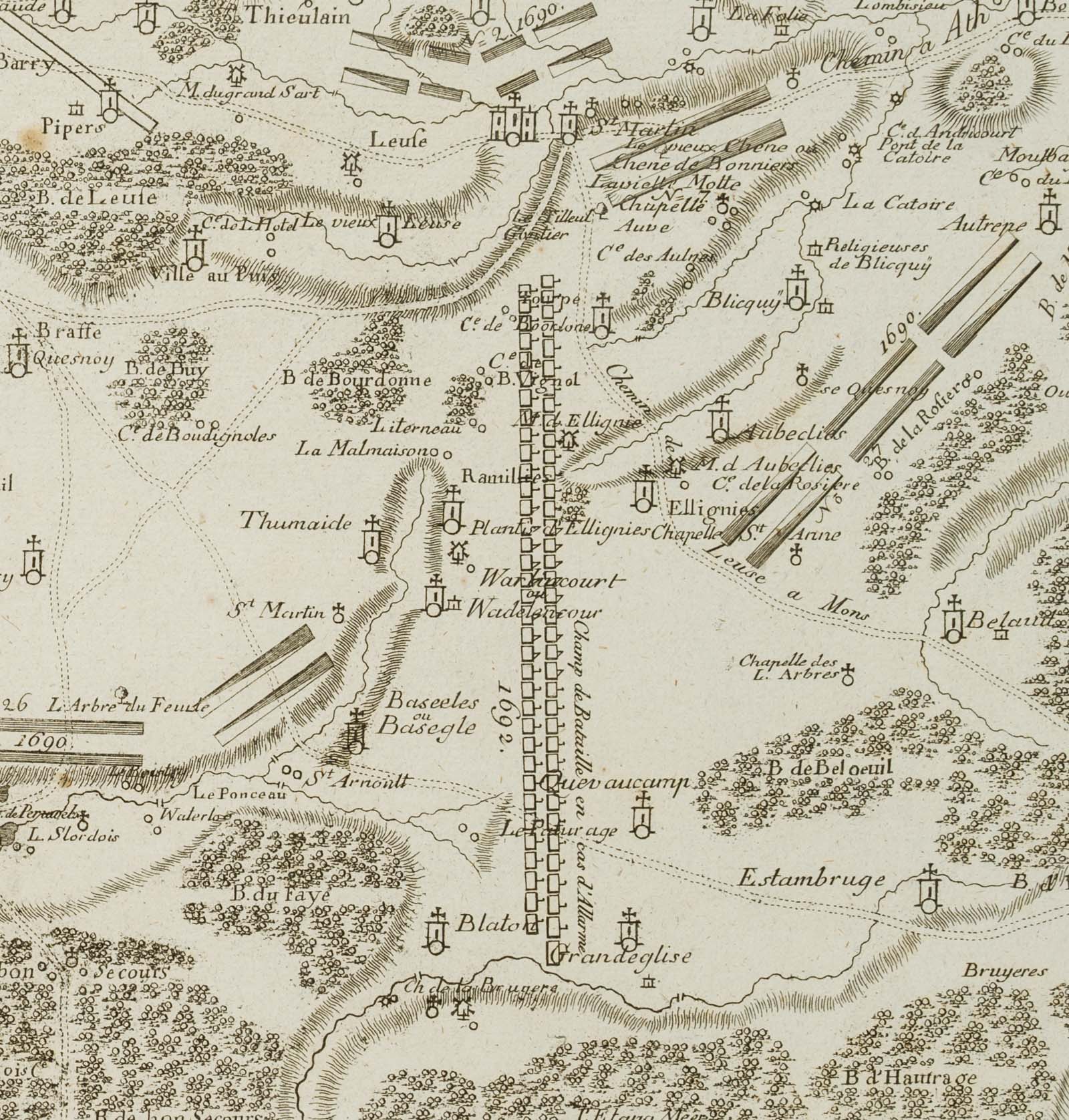
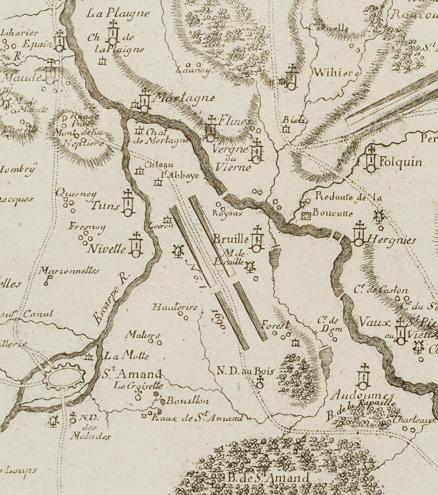
- Beschreibung: Die vorliegende detaillierte karthographische Karte zeigt die Region um Tournai, Conde, Ath / Aat, Chievre und Saint-Ghislain in Belgien und Frankreich.
In der Titelkartusche in der linken unteren Ecke bezeichnet und datiert: „Carte des Villages de la Chatellerie D’ATH, ou l’Armée etoit en Quartier de Fourage le 7. Octobre 1692.“; oben links innerhalb der Druckplatte nummeriert mit: „Sectio 13“.
Aus einem berühmten Antiquariat aus München. - Quelle: Chevalier de Beaurain (1696 -1771 ) Histoire Militaire de Flandre depuis l’Annee 1690 jusqu’en 1694, 1756 |
- Schlagworte: Landkarten, Militär, Frankreich, Gegenständlich, 1750-1799
- Größe: 36,4 cm x 57,0 cm, Druckplatte: 33,7 cm x 54,0 cm, Darstellung: 30,3 cm x 51,0 cm
- Zustand: Guter Zustand. Die Karte ist altersgemäß gebräunt und stockfleckig, im Rand stellenweise mit Knickspuren; punktuell an einer Stelle im Bereich der Darstellung ist das Papier leicht ausgedünnt. Das Blatt wurde über die Mitte vertikal gefaltet. Die Darstellung macht einen guten Eindruck.
English Version:
Unknown (18th century), Antique map, Belgium, France, Ath, Conde, 1776, Copper engraving
- Technique: Copper engraving on
- Date: 1776
- Description: This detailed cartographic map shows the region around Tournai, Conde, Ath / Aat, Chievre and Saint-Ghislain in Belgium and France.
Inscribed and dated in the title cartouche in the lower left corner: „Carte des Villages de la Chatellerie D’ATH, ou l’Armée etoit en Quartier de Fourage le 7. Octobre 1692.“; numbered in the upper left inside the printing plate with: „Sectio 13“.
From a famous antiquarian bookshop in Munich. - Source: Chevalier de Beaurain (1696 -1771 ) Histoire Militaire de Flandre depuis l’Annee 1690 jusqu’en 1694, 1756 |
- Keywords: 18th century, Figurative, Maps, France,
- Size: 36,4 cm x 57,0 cm (14,3 x 22,4 in), Plate: 33,7 cm x 54,0 cm (13,3 x 21,3 in), Depiction: 30,3 cm x 51,0 cm (11,9 x 20,1 in)
- Condition: Good condition. The map is browned and foxed due to its age, with traces of creasing in the margin in places; the paper is slightly thinned in one spot in the area of the illustration. The sheet has been folded vertically across the centre. The image makes a good impression.