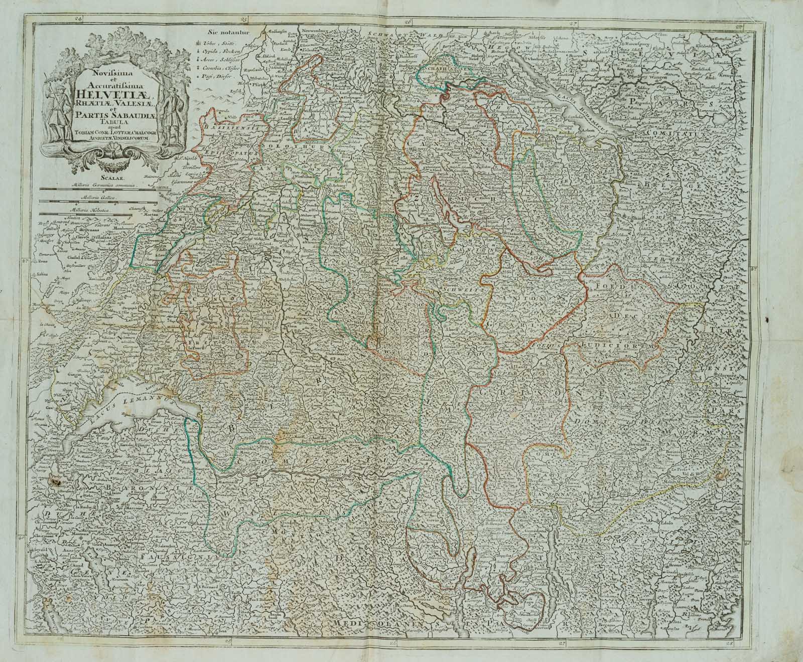
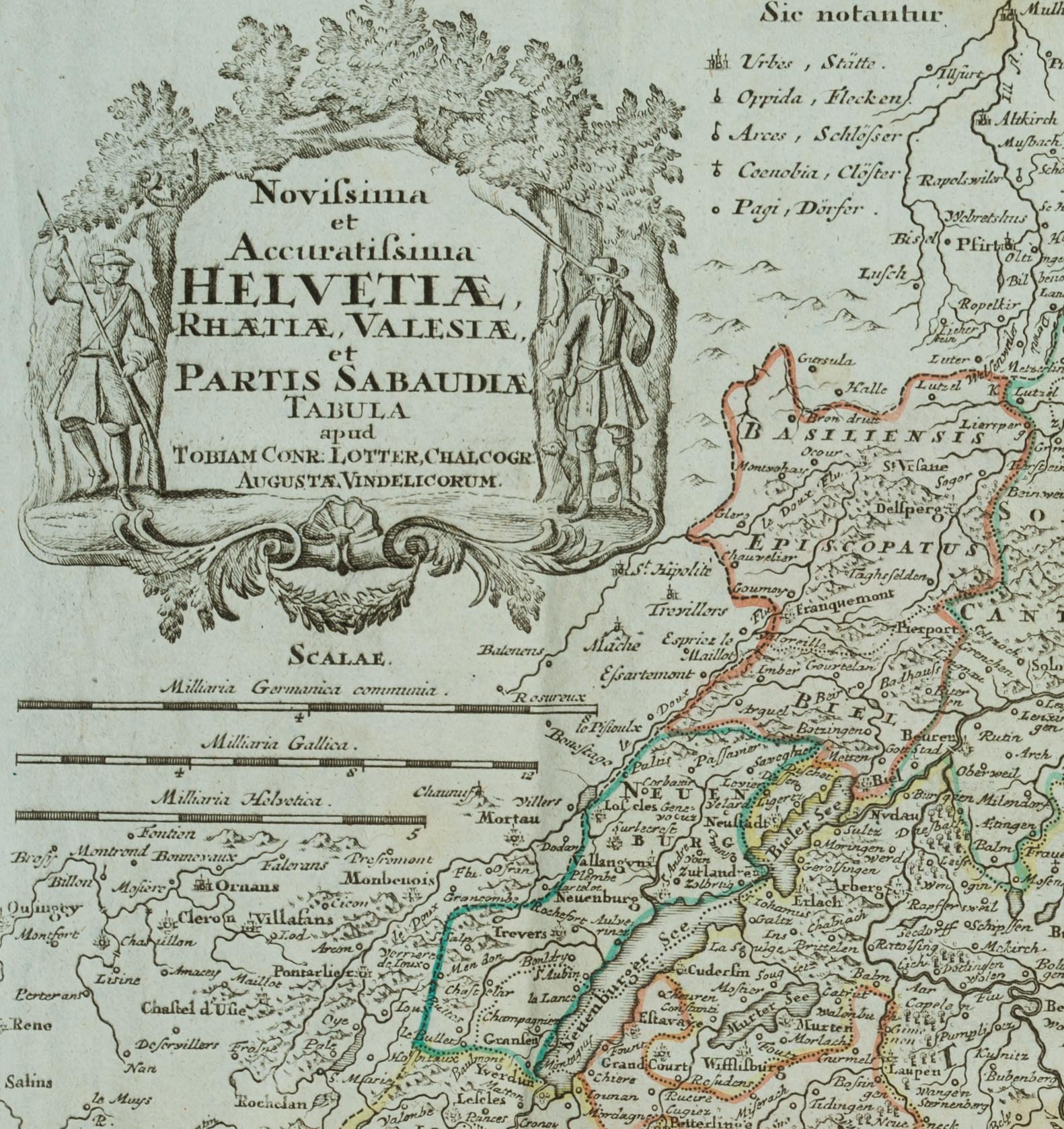
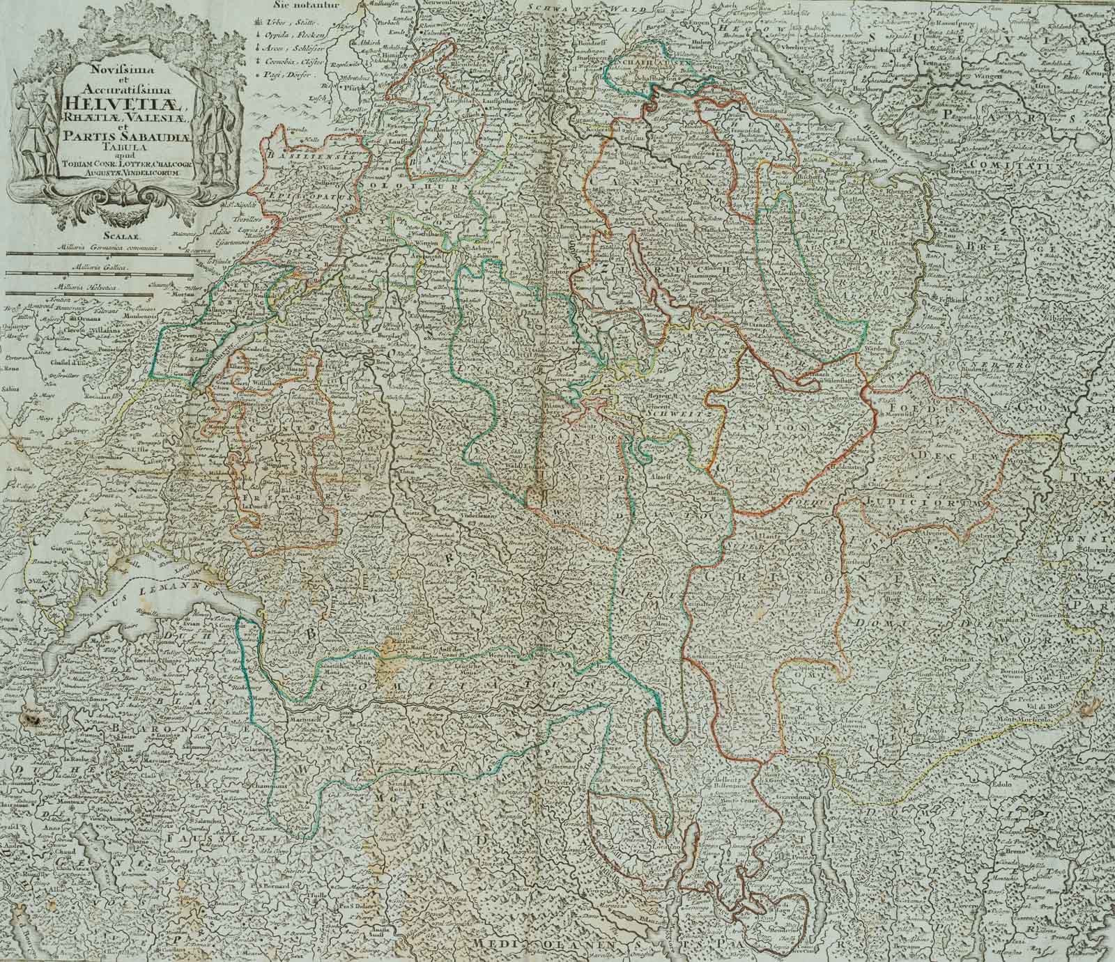
Unbekannt (19. Jahrhundert), Historische Landkarte der Schweiz. Helvetiae, Rhaetiae, Valesiae, 19. Jahrhundert, Kupferstich
- Technik: Kupferstich auf Papier
- Datierung: 19. Jahrhundert
- Beschreibung: Detaillierte historische Karte der Schweiz mit Liechtenstein, Norditalien und der Region um den Bodensee. Beschriftet mit: „Novissima et Accuratissima HELVETIA RHATIA, VALESIA, et PARTIS SABAUDIA TABULA apud TOBIAM CONR: LOTTER, CHALCOGR AUGUSTA VINDELICORUM“.
- Schlagworte: Landkarten, Schweiz, Barock, 1800-1849
- Größe: 54,7 cm x 70,7 cm, Darstellung: 48,2 cm x 56,4 cm
- Zustand: Die Karte wurde gefaltet und trägt Knickspuren mehrere senkrechte und eine waagerechte Knickspur. Das Blatt hat sich altersgemäß verfärbt. Die Ränder sind durch Knicke und Einrisse beschädigt und weisen Schmutz-, Flüssigkeits- und Stockflecken auf. Auf der Karte sind geringfügige Stellen mit Blattverlust festzustellen. Dieser Karte hat Patina. Man sieht ihr das Alter und die Benutzung an.
English Version:
Unknown (19th century), Historical map of Switzerland Helvetiae, Rhaetiae, Valesiae, 19th century, Copper engraving
- Technique: Copper engraving on Paper
- Date: 19th century
- Description: Detailed historical map of Switzerland with Liechtenstein, northern Italy and the region around Lake Constance. Inscribed with: „Novissima et Accuratissima HELVETIA RHATIA, VALESIA, et PARTIS SABAUDIA TABULA apud TOBIAM CONR: LOTTER, CHALCOGR AUGUSTA VINDELICORUM“.
- Keywords: 19th century, Baroque, Maps, Switzerland,
- Size: 54,7 cm x 70,7 cm (21,5 x 27,8 in), Depiction: 48,2 cm x 56,4 cm (19 x 22,2 in)
- Condition: The map has been folded and bears crease marks several vertical and one horizontal crease mark. The sheet has discoloured according to its age. The edges are damaged by creases and tears and show dirt, liquid and foxing stains. There are minor areas of sheet loss on the map. This map has patina. It shows age and use.