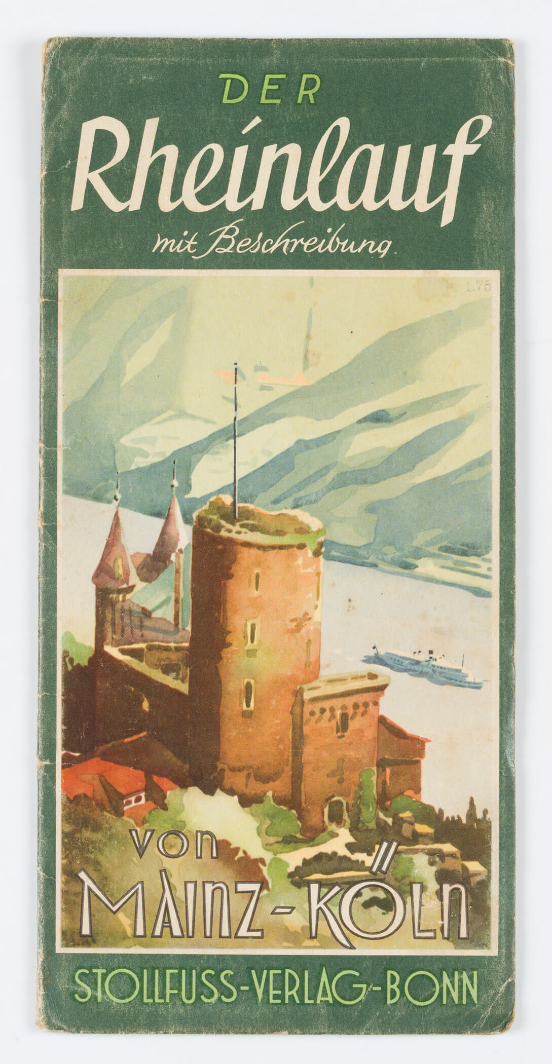
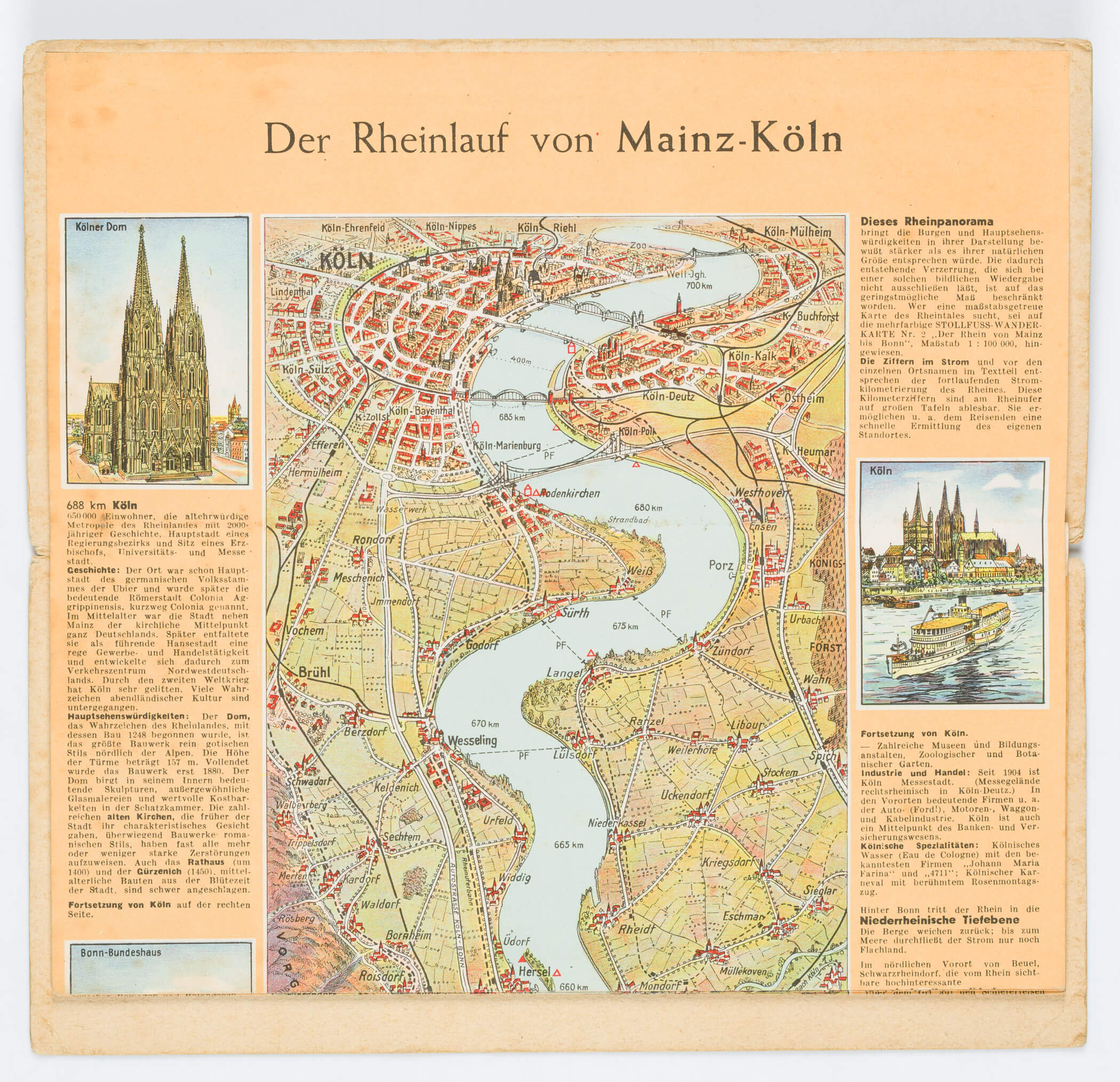
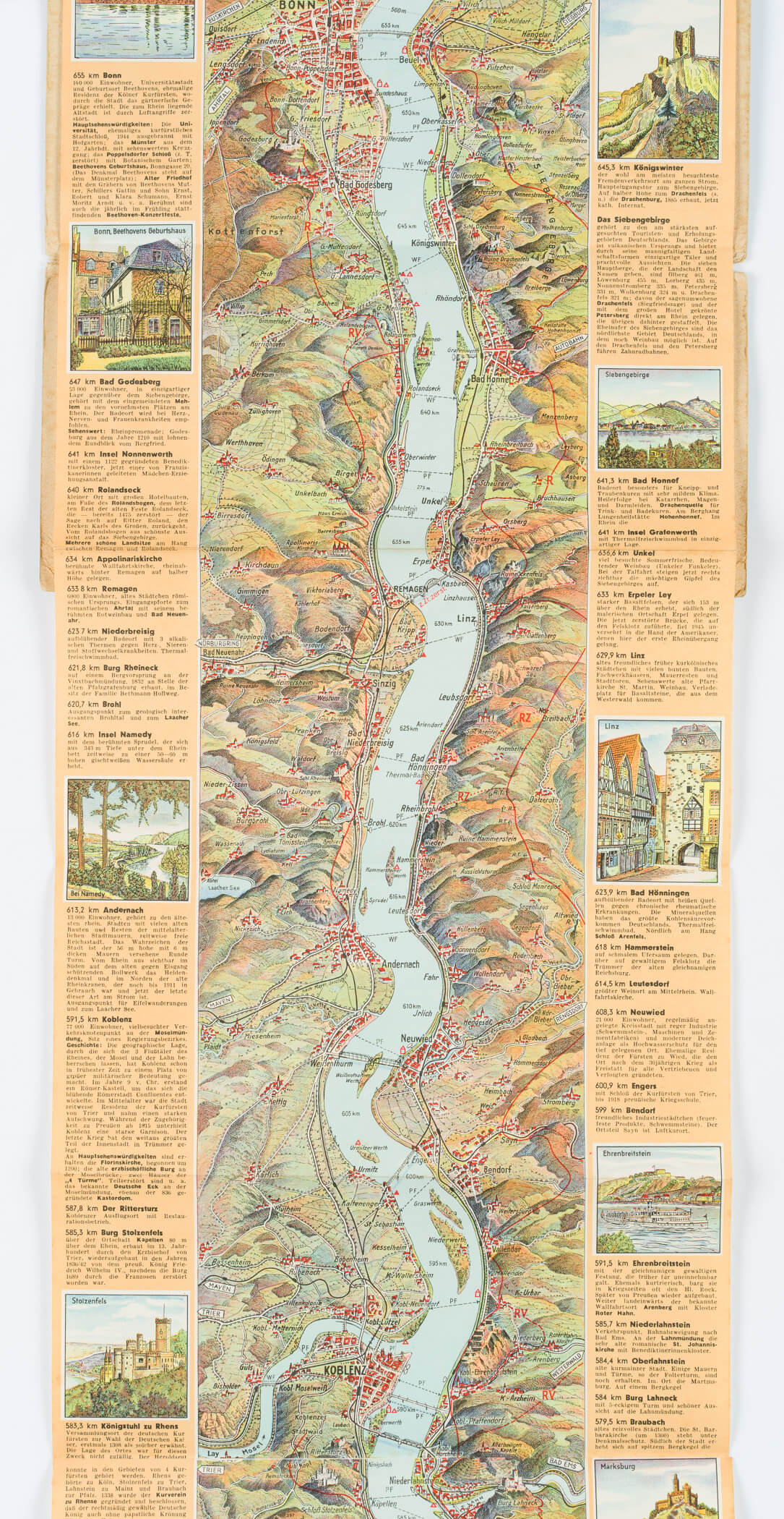
Unbekannt (20. Jahrhundert), Gefaltete Landkarte. Der Rheinlauf mit Beschreibung von Mainz-Köln, um 1930, Druckerzeugnis
- Technik: Druckerzeugnis auf Papier
- Datierung: um 1930
- Beschreibung: Herausgegeben vom Wilhelm Stollfuss Verlag Bonn, Kartographisches Institut. Faltkarte in Farbe mit Beschreibungen und Illustrationen am Rand.
- Schlagworte: Kartographie, Faltkarte, Landkarte, Ausflug, Rheinland, Rheinlauf, Rheintour, Landkarten, Deutschland, Bonn, Romantik, 1925-1949
- Größe: 26,3 cm x 12,5 cm
- Zustand: Sehr guter Zustand. Das Papier hat sich altersgemäß verfärbt. Der Einband trägt leichte Gebrauchsspuren. Die Ränder der Karte sind stellenweise leicht stockfleckig und tragen kleine Knicke an den Ecken. Größe der aufgeklappten Karte: 147 x 25 cm
English Version:
Unknown (20. Jahrhundert), Map The course of the Rhine Mainz-Cologne, c. 1930, Print product
- Technique: Print product on Paper
- Date: c. 1930
- Description: Published by Wilhelm Stollfuss Verlag Bonn, Kartographisches Institut. Folding map in colour with descriptions and illustrations in the margin.
- Keywords: Cartography, folding map, map, excursion, Rhineland, Rhine course, Rhine tour, 20th century, Romanticism, Maps, Germany,
- Size: 26,3 cm x 12,5 cm (10,4 x 4,9 in)
- Condition: Very good condition. The paper has discoloured with age. The binding shows slight signs of use. The edges of the map are lightly foxed in places and bear small creases at the corners. Size of the unfolded map: 147 x 25 cm