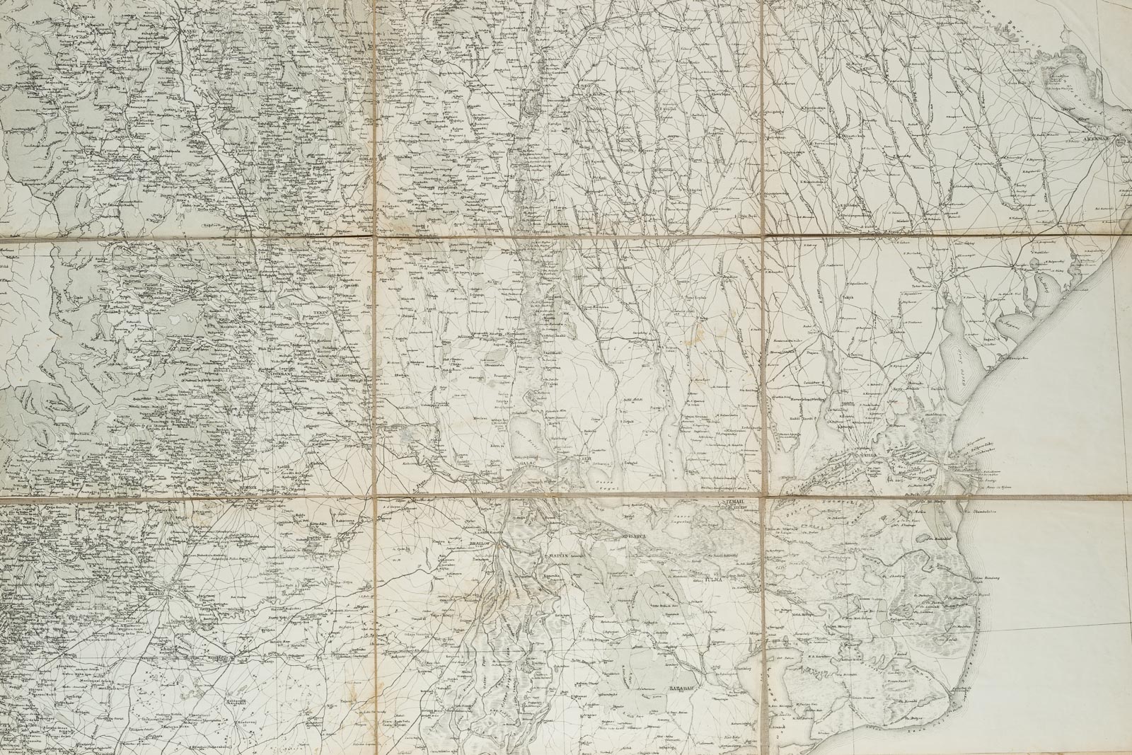
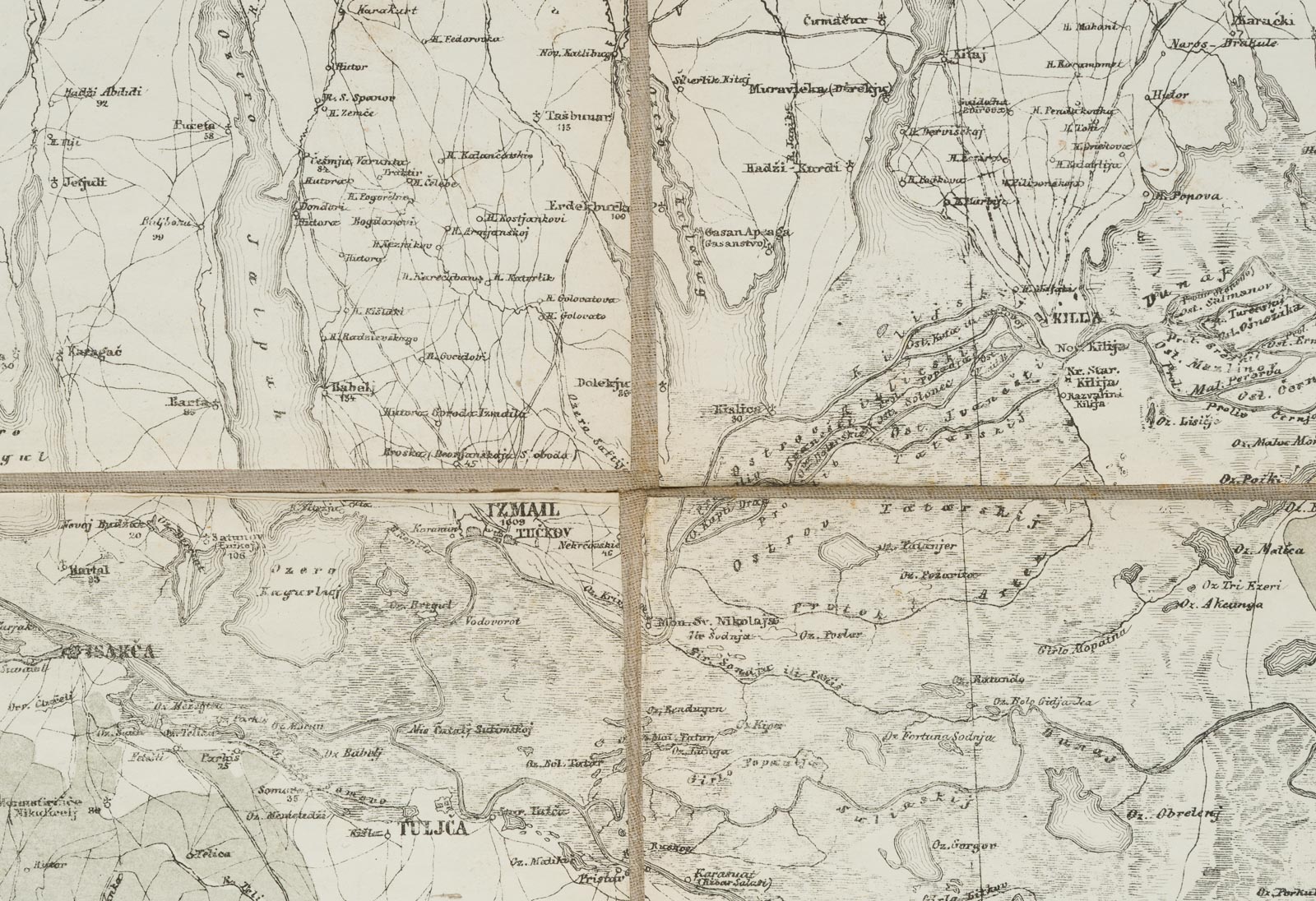
Unbekannt (20. Jahrhundert), Topographische Karte des Balkan, 9-Teilig, um 1900, Kupferstich
- Technik: Kupferstich auf Papier
- Datierung: um 1900
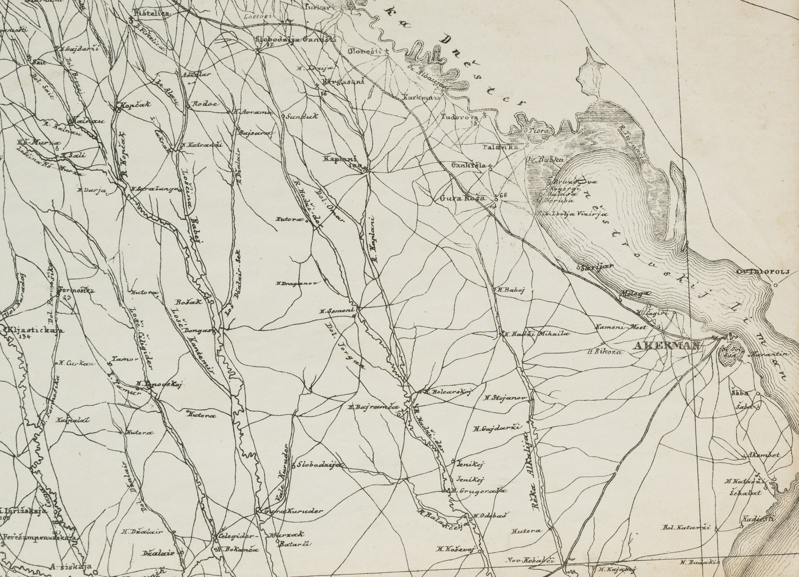
- Beschreibung: Balkankarte mit Rumänien und Moldawien. Die Karte zeigt westlich Foksani, eine Stadt im Osten Rumäniens, sowie Ismajil und Tulcea im Osten, wo sich das Schwarze Meer anschließt. Verso auf der Leinwand bezeichnet: „Balkan“.
Aus dem Nachlass des Antiquars Rosenthal München / Amsterdam. - Schlagworte: Landkarten, Rumänien, Gegenständlich, 1900-1924
- Größe: 50,0 cm x 76,0 cm
- Zustand: Guter Zustand. Original-Karte, altersbedingt verfärbt mit Gebrauchsspuren; infolge der Montage stellenweise leicht gewellt.
English Version:
Unknown (20th century), Topographic Map of the Balkans, 9-part, c. 1900, Copper engraving
- Technique: Copper engraving on Paper
- Date: c. 1900
- Description: Balkan map with Romania and Moldova. The map shows Foksani, a town in the east of Romania, to the west and Ismajil and Tulcea to the east, where the Black Sea adjoins. Inscribed on the verso of the canvas: „Balkan“.
From the estate of the antiquarian bookseller Rosenthal Munich / Amsterdam. - Keywords: 20th century, Figurative, Maps, Romania,
- Size: 50,0 cm x 76,0 cm (19,7 x 29,9 in)
- Condition: Good condition. Original map, discoloured due to age with traces of use; due to mounting slightly wavy in places.